Prefecture
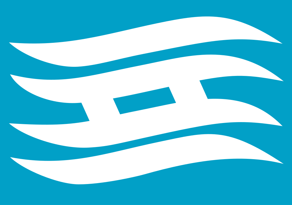
Hyōgo (兵庫県, Hyōgo-ken) flies a cerulean-blue flag bearing a white, wave-shaped rendering of 兵 (“hyō”), the first character of its name — adopted in 1964 and designed so its curves evoke the sea lapping the prefecture from both north and south. An older, more geometric version of the same character serves as Hyōgo’s official prefectural emblem, dating to 1921. Centred on the port city of Kobe, Hyōgo is one of Japan’s few prefectures to touch two different seas, a legacy of its unusually complex 19th-century formation from five historical provinces.
Flag
Not available
| Prefecture | Hyōgo (兵庫県, Hyōgo-ken) |
|---|---|
| Type | Ken (県) — ordinary prefecture |
| Region | Kansai (Kinki), Honshu |
| Capital | Kobe |
| Established | 23 May 1868 as the original Hyōgo Prefecture (around the port of Kobe); reached its present borders in August 1876 after absorbing Harima, Tajima, Awaji, and part of Tanba provinces |
| Prefectural emblem (kenshō) | Squared, geometric rendering of 兵 (“hyō”); adopted 10 February 1921 (Notice No. 81) |
| Prefectural flag (kenki) | White wave-styled 兵 on cerulean blue; adopted 10 June 1964 |
| Official tree | Camphor tree (kusunoki), designated 1966 |
| Official flower | Nojigiku, a native white chrysanthemum, designated 1954 |
| Official bird | Oriental white stork (kōnotori), designated prefectural bird in 1965; nationally a special natural monument since 1956 |
Flag of Hyōgo — Cerulean-blue field, white wave-styled “hyō” character, adopted 1964
The flag of Hyōgo is a field of cerulean blue bearing a single white character: a stylised, wave-form rendering of 兵 (hyō), the opening kanji of “Hyōgo.” According to the prefectural government, the design deliberately bends the character’s strokes into wave shapes so that it reads as the prefecture’s land framed by sea on two sides — the Sea of Japan to the north and the Seto Inland Sea to the south. Sources describe the blue as representing openness or youthful vigour and the white as brightness and sincerity, though English-language summaries vary slightly in how they phrase this symbolism.
Distinct from the flag is Hyōgo’s older prefectural emblem (県章, kenshō): the same 兵 character, but squared off into a compact, geometric block rather than flowing waves. The emblem appears on government buildings, official awards, and civil infrastructure, while the flag is used for ceremonial and representational display.
23 May 1868 — The first Hyōgo Prefecture. In the early days of the Meiji Restoration, a local government office was established around the newly opened treaty port of Kobe and took the name Hyōgo, after the historic anchorage of Hyōgo-no-tsu. Itō Hirobumi, later a four-time prime minister, served as its first governor.
1871–1876 — Consolidation. Following the 1871 abolition of the old feudal domains (haihan-chiken), the map of the region was redrawn repeatedly. In August 1876, Hyōgo absorbed the neighbouring former provinces of Harima, Tajima, and Awaji, along with part of Tanba, joining them to the core territory that had grown out of Settsu province — one of the more complex prefectural mergers of the era, and the origin of the “Five Provinces” (Settsu, Harima, Tajima, Awaji, Tanba) still used today to describe Hyōgo’s distinct sub-regions.
10 February 1921 — The prefectural emblem. Prefecture Notice No. 81 adopted the squared 兵 emblem, reportedly designed by a public-works official under then-governor Ariyoshi Chūichi, following an in-house design process.
10 June 1964 — The prefectural flag. A separate flag using a wave-form treatment of the same character was adopted, coinciding with sources that link the date to the completion of a new prefectural government office building.
Because of its 1876 merger, Hyōgo is unusual among Japan’s 47 prefectures in touching coastlines on both sides of the country: the Sea of Japan along its northern Tajima coast, and the Seto Inland Sea to the south around Kobe and Harima, with a further stretch of Pacific-facing coast on Awaji Island along the Kii Channel. This geography is the explicit inspiration for the flag’s wave motif.
A cerulean-blue field bearing a white character shaped like waves: a stylised rendering of 兵 (hyō), the first kanji of Hyōgo, designed so its curves evoke the sea on both sides of the prefecture.
The flag was adopted on 10 June 1964, reportedly to mark the completion of the new Hyōgo Prefectural Government office building. It is distinct from, though related in motif to, the older prefectural emblem of 1921.
The 1921 emblem (kenshō) renders the same “hyō” character in a squared, geometric block form and is used mainly on buildings, awards, and infrastructure. The 1964 flag uses a separate, more fluid wave-styled rendering of the same character designed specifically to symbolise the prefecture’s two coastlines.
Hyōgo is one of the few Japanese prefectures to reach both the Sea of Japan, on its northern Tajima coast, and the Seto Inland Sea (with a further Pacific-facing stretch on Awaji Island’s Kii Channel side) to the south, a result of the 1876 merger of the historical provinces of Settsu, Harima, Tajima, Awaji, and part of Tanba.
Last reviewed by the Emblema Mundi editorial team on 2026-07-04.